PISSING IN THE WIND
The almighty, indomitable force of nature is all too evident. A casual waft through the broadsheets will usually uncover at least one tale of flooding, earthquakes, storms, forest fires or some other so-called act of God, a Damoclean sword swipe at our complacency.
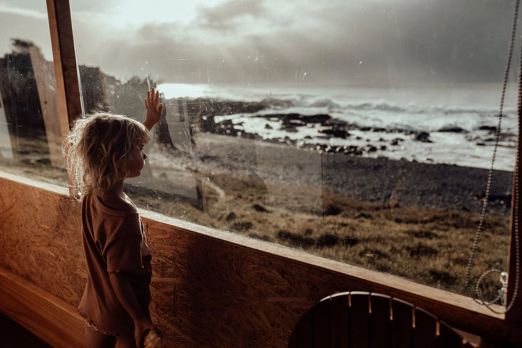
We sit in our cocoon of safety here in the Byron Shire, for the most part sheltered from all mother nature can rain down upon us. The occasional bit of flooding, sure, a bit of a blow out of the east every now and again granted, but we aren’t talking monsoons of Bangladeshi proportions or hurricane Katrina-like decimation. We pity the world, view the media with sadness and compassion and whisper a little something to the man upstairs, safe and grateful in the knowledge that it could never happen to us.
…or could it?
Cyclones are usually thought to hit up north and do little more than strip a couple of trees or peel away some roofing by the time the reach us. Damage is done, and there is nothing meek about their presence, but it would be hard, even of the worst-case scenarios of the past three decades, to call them natural disasters. But this wasn’t always and will not always be the case.

Max Pendergast is a Byron local. He didn’t move up from Sydney as a teenager and take a job at the old Norco plant, he didn’t unstrap his longboard from the roof of a kombi some time in the early ’70s and decide to call Byron home. He, like his mother and grandmother before him and his children after him, is born, bred, raised and reared Byronian – a truly rare breed. He has seen it all: the end of whaling, the scars of mineral mining, the overwhelming influx of tourism…and the cyclones.
“We’ve had East Coast lows with 135km/h gusts,” recalls Max, “but that’s absolutely nothing. Cyclone Althea, that hit Townsville in 1971, had enough power to peel the ceramic tiles off the walls of the bank. My dad used to have a 75-foot high steel TV antenna in the back yard. It was a big, triangular thing with stay-wires. We came outside after one big cyclone and it was just tied in a knot.”
They may be few and far between and they may be an accumulation of extreme conditions, but those conditions do occur and the ten-year cycle is well overdue.
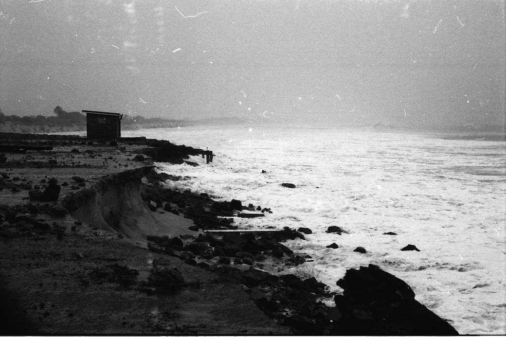
Byron’s explosion in commerce and population over recent decades has been without consideration of these maelstroms. Mineral mining has debilitated much of the bay’s natural, geological foundations and its primary defense against any significant onslaught. Until the early ’70s, the coastline from Belongil right through to Clarke’s Beach was significantly different, with high, stable dunes, reaching as much as 12 metres above sea level, defying the ocean’s challenges.

“Before they mined Main Beach, we used to play in those sand hills and they were massive,” recounts Max. “Now they’d be lucky if they were four metres above sea level. In the middle of the hills was a fresh water lake, crystal clear, like at Fraser Island. After one cyclone in 1954, I went over the sand hills to have a look at the lake (roughly where the YAC now stands), and there were parts of fishing trawlers, which had been moored to the jetty at Childe Street, in the lake. The only way they could have got there is if one big wave had taken them up and over those 12-metre dunes.”
What the sea wants, she will have, and there is very little we can do to stave off such an assault. Max recounts tales of giant, defensive boulders being tumbled along the beach like marbles, vast areas of sand being wiped from the map overnight and fishing trawlers being left high and dry in the tops of trees. And on more than one occasion, he has been lucky to have received the ocean’s mercy, twice spared his life by Mother Nature’s wrath.
“There used to be a road in front of all the houses right down to Belongil,” he shares of his first near-death experience, though the humble gentleman would likely deny this grandiose claim. “But when we had a big cyclone one year, that all went. We were staying down there with friends in around 1964 or ’65. Yvonne (Max’s wife) got up the next morning to check the surf and it was under the house and the concrete stairs were about six metres down on the beach. About 20 metres of dunes had disappeared overnight.” Five more metres and Max, Yvonne, the building and all its occupants would have been erased from the shoreline.
Then, in late February of 1973, Cyclone Kirsty struck. With the old surf club, which was located at the southern end of Main Beach car park, under threat from the pounding waves, Max and the local copper rushed in to try and save as much paraphernalia as possible. With a thunderous roar, water started seeping in through the weatherboards high above Max’s head before the double doors at the front of the building blew open and a six-foot cube of ocean burst through, crashing against the back wall and very nearly washing Max out to sea.

Man’s impact has been devastating to the coastline, and subsequent attempts to reclaim or reinforce the land have been futile. “When they mined the Belongil (circa 1970), all the coffee rock that’s there, which had been the base of the old sand hills for millions of years maybe, went. After that, they built a tea tree fence and dumped a bunch of car bodies in there (to try and stabilise the dunes), but it was just pissing in the wind. If you get a cyclone to the north and a big, easterly swell coming in, the amount of sand that will move is amazing. During one cyclone, we thought we’d reclaim some pipeline. It was buried six metres down under sand hills that stretched for 60 metres, and we got three six-metre lengths of that pipe out in an hour – 18 metres of dunes were just washed away. We watched the whole landscape of the place change within that single hour.”
As well as this, there has been no acknowledgement of such possibilities in much of the town’s planning. Shirley Street and Ewingsdale Road would be gone, the town cut off from its one major exit route, the Beach Hotel would be immediately flooded, serving as a funnel, channeling the ocean straight down Jonson Street and engulfing the town’s CBD, and nowhere, from Fish Heads on the beachfront to Mitre 10 at the far end of Jonson Street would remain unscathed. It is not common knowledge, though takes little to recognise, that Byron’s town centre is actually below sea level. Like the walls of a castle, the shoreline from Belongil to the Cape serve as a barricade, keeping the waves at bay, a tenuous rampart against the ocean’s might. But, if that were to be breached, nothing would stand in the way.


Synoptic charts of Jan. 1967 Cyclone Dinah
“At the moment, any sense of defense infrastructure is totally unfeasible,” Max hypothesises. “If we were to get a storm surge, like they have just suffered in the Philippines, the town would be gone. Years ago, there was an article in the Byron News of an old report of whitewater coming all the way back to what is now the RSL club. I don’t think any of the current town council has ever seen a cyclone like that – they just don’t know. They’ve just got no concept of what a big cyclone can do. Most people don’t even realise that the town is actually built below sea level.”
So is this a tale of impending armageddon, a “the end is nigh”, Four-Horsemen-of-the-Apocalypse pessimistic perspective of Byron’s future? Who can say. We don’t know when or even if the next big cyclone will arrive. Perhaps, with the world’s changing climate, the ever-developing coastline and a little blind luck, the dangerous days are over. Maybe this is a nice little history lesson and nothing more.
Maybe…but then again…maybe not…

All Photos: ©Max Pendergast
– This article first appeared on Common Ground Australia on Dec 20, 2013